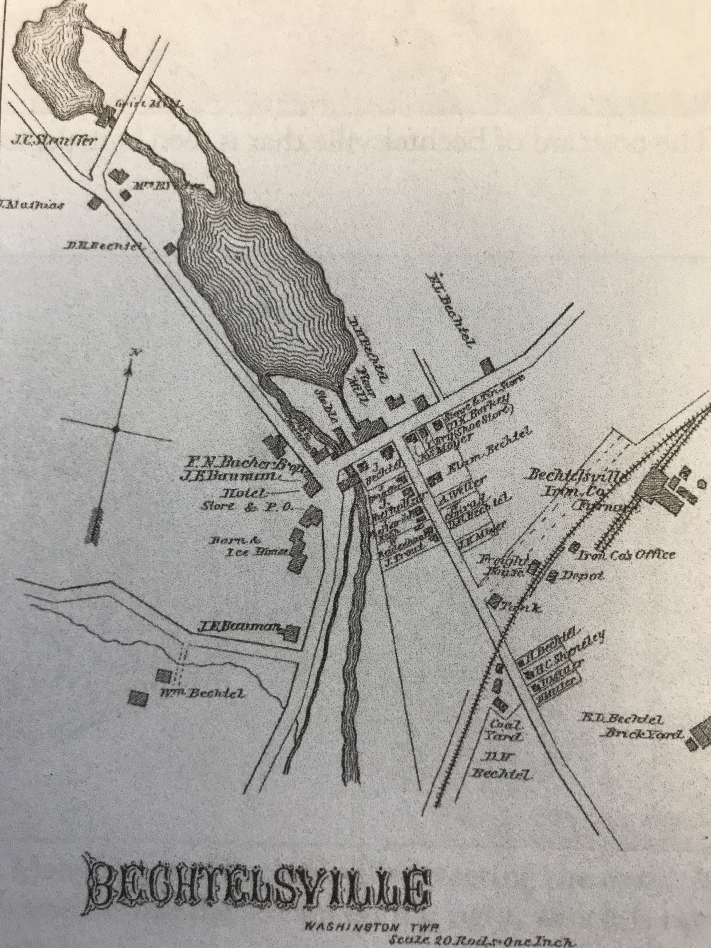
I found this old map of Bechtelsville. It definitely shows Swamp creek being dammed up in two different locations. It looks like the upper dam was used for a grist mill and the lower for a flour mill. I always thought that a grist mill was a flour mill but what do I know?


No comments:
Post a Comment